

Journeying Through Malta

The A to Z of Malta
Birkirkara
Is the largest and most populated town on the island, with a population of over 25,000 people, and also considered one of the oldest towns in Malta, with a history dating back to prehistoric times.
Historically, it has been an agricultural community, known for its fertile land and farming activities. Over the years, it has transformed into a residential and commercial hub, with various amenities and services available to its residents. Despite its urban development, Birkirkara still retains some of its traditional characteristics, such as narrow streets and old buildings.
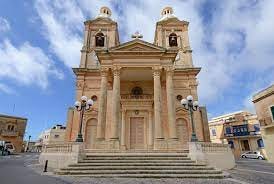
One of the prominent landmarks in Birkirkara is the Parish Church of St Helen, dedicated to the town's patron saint. The church is known for its imposing facade and beautiful interior, featuring religious artworks and sculptures.
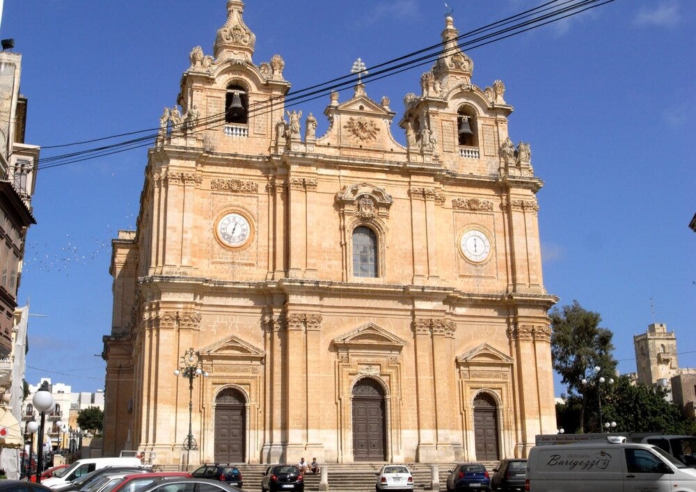
Parish Church of St Helen
The town offers various amenities, including schools, shopping centres, restaurants, and recreational areas. Overall, Birkirkara is a bustling town, combining elements of its rich history with modern urban living.
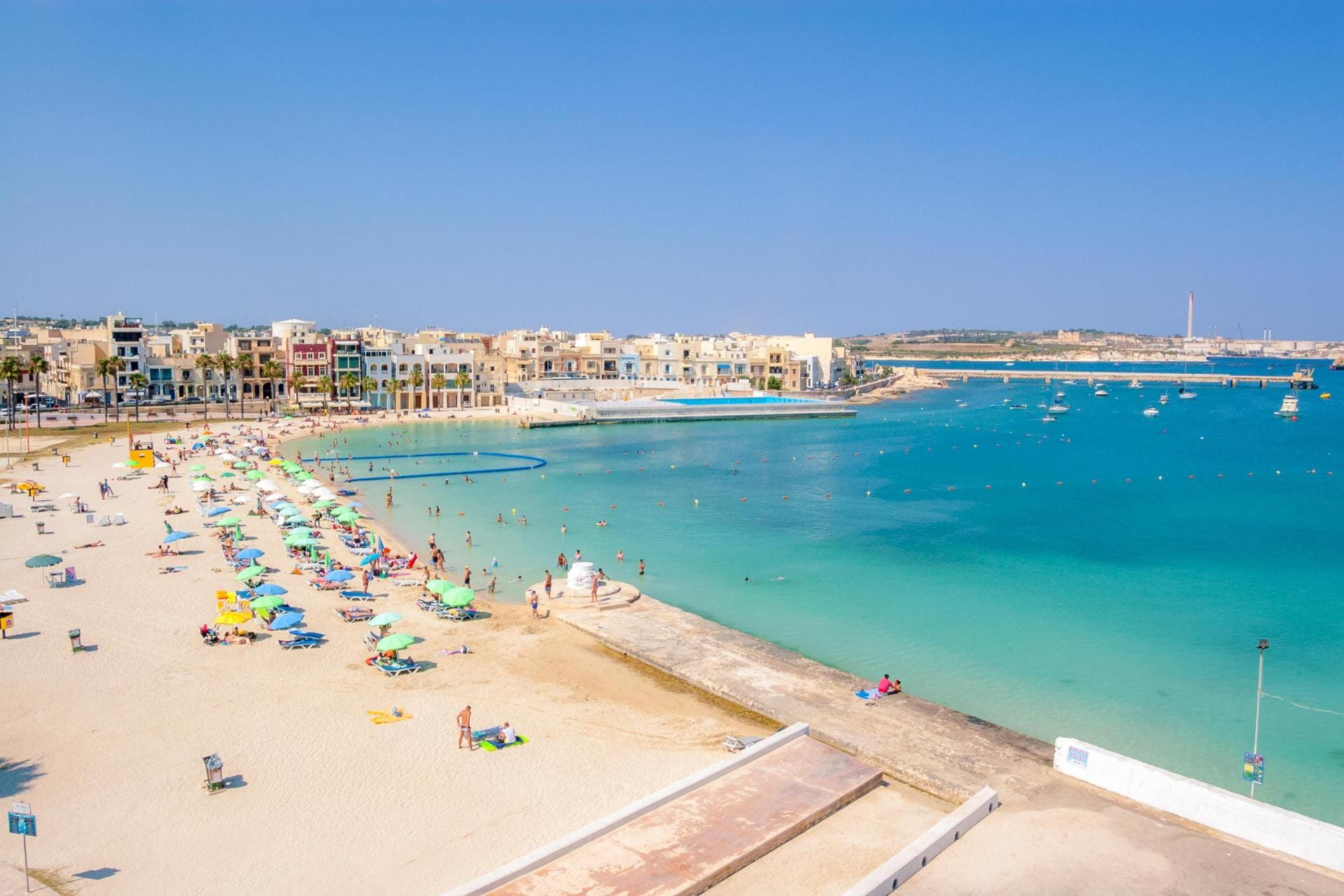
Birzebbuga
Is a small seaside town located on the southern coast, and is situated about 5 miles south of Valletta. With a population of around 10,000 people, Birzebbuga is known for its picturesque coastal views and relaxed atmosphere.
The town's name, is derived from the Maltese word for ‘well of olives’, reflecting its connection to olive farming. Although the town has undergone some development in recent years, it still retains a charm of its own, with a mix of traditional Maltese architecture and modern amenities.
Birzebbuga is renowned for its beautiful sandy beaches, including Pretty Bay, which is the main beach in the area. The bay is a popular destination for both locals and visitors, offering clear blue waters and ample space for swimming, sunbathing, and water sports.
Apart from its natural attractions, it is home to the Freeport, which is Malta's main cargo port. The Freeport plays a significant role in the country's economy and handles a substantial volume of international trade. The presence of the port has also contributed to the growth of industrial and commercial activities in the area.
Birzebbuga celebrates its annual feast dedicated to St Peter, the patron saint of the town, in late June or early July and features boat races, fireworks, street decorations, and religious processions.
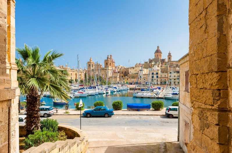
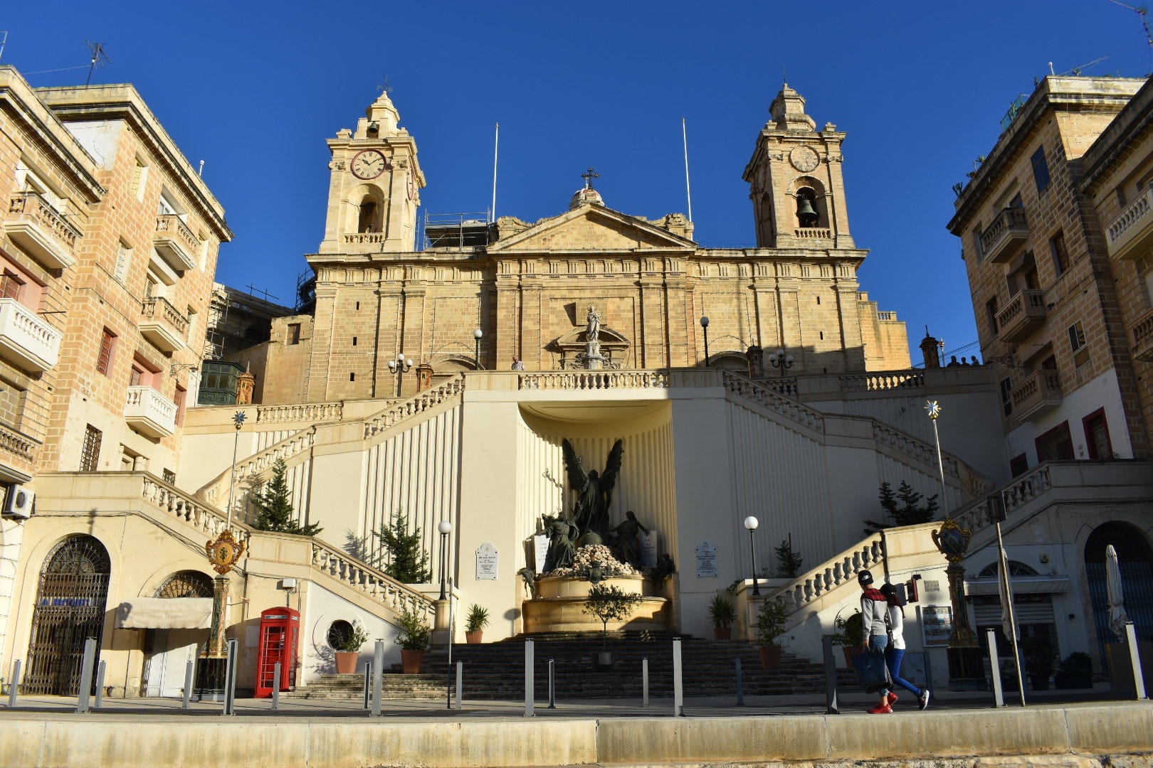
Cospicua
Also known as Bormla, is a fortified city located on the eastern side of the Grand Harbour. It is one of the Three Cities, along with Senglea and Vittoriosa, and forms part of the Cottonera region. Cospicua is situated across the water from Valletta, and is connected to it by ferry services and a road network.
Cospicua has a history that dates back to ancient times. The originally settlers were the Phoenicians but later came under the rule of the Romans, Byzantines, and Arabs. The Knights of St John, fortified the city during the 16th century, and the fortifications, known as the Cottonera Lines, were built to defend the Grand Harbour and remain a prominent feature of the city today.
The architecture of Cospicua is a blend of different styles and periods. The city's narrow winding streets are lined with traditional Maltese townhouses, with colourful balconies and decorative features. The waterfront area, known as the Kalkara Creek, is a picturesque setting with a promenade, marina, and views of the harbour.
The city is home to several historical landmarks. One of them is the Parish Church, dedicated to the Immaculate Conception. The church features a stunning Baroque facade and contains valuable religious artworks. The city also has a number of other churches, chapels, and historic buildings.
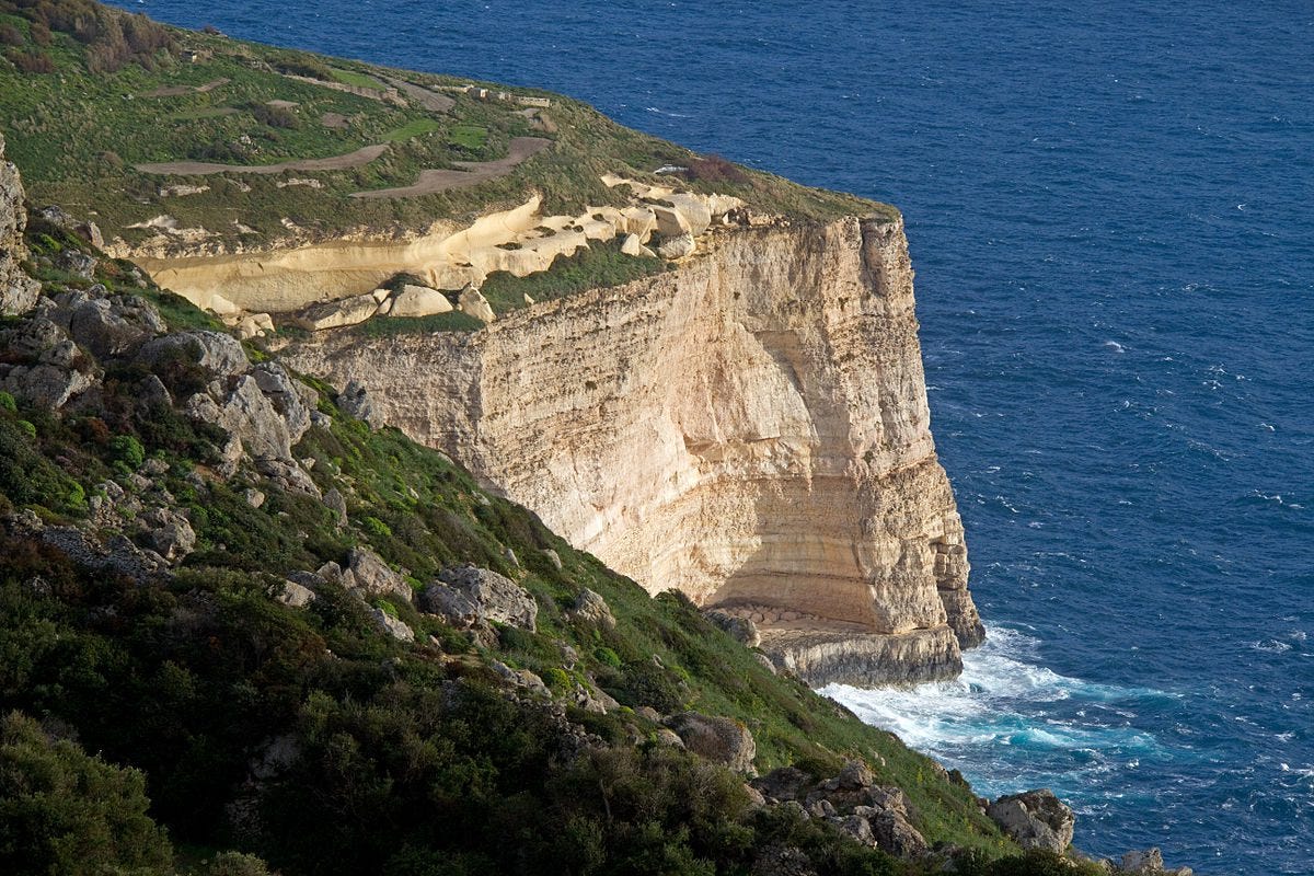
Dingli
Dingli is a small village located on the western coast, and is known for its cliffs, which are the highest point on the island. The Dingli Cliffs offer panoramic views of the Mediterranean Sea and the surrounding countryside.
These majestic limestone cliffs stretch for several miles, rising up to around 250 metres above sea level. The cliffs are a popular spot for visitors who want to enjoy the natural beauty of Malta and take in the stunning views. There are also paths along the cliffs, allowing visitors to explore the area on foot.
In addition to the cliffs, Dingli is home to the 17th century parish church dedicated to the Assumption of the Blessed Virgin Mary.
Dingli is a peaceful rural village, providing a stark contrast to the more bustling areas of Malta. It offers a tranquil atmosphere and a chance to experience the island's natural landscapes away from the crowds. The village has a small community and a handful of local establishments, including restaurants and cafés, where you can enjoy traditional Maltese cuisine.
Fgura (pronounced Figura)
Fgura is a suburban town located in the southern part of Malta, just a few miles away from the capital city, Valletta. It is one of the largest towns in Malta and has a population of around 12,000 residents.
Fgura developed in the late 1960’s to respond to the increasing population and the need for housing. As a result, it is a relatively modern town compared to some of the older settlements on the island. The town primarily consists of residential areas, with a mix of apartment blocks and terraced houses.
The town has a range of amenities and facilities, with several supermarkets, shops, and restaurants scattered throughout the town.
There are a number of green spaces and parks which include the Fgura Gardens and the Sir Luigi Preziosi Gardens. Sir Luigi Preziosi was a renowned opthalmic surgeon.
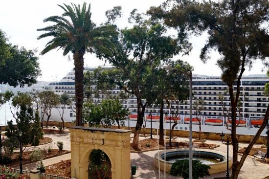
Fgura Gardens
While Fgura is not a major tourist destination, it does provide a glimpse into everyday Maltese life. It allows visitors to experience a suburban town away from the more touristy areas and is a convenient base for exploring the rest of the island.
More About Maltese Weather
As you know, the Maltese Islands enjoy a typical Mediterranean climate. Although there is a Spring and Autumn, the year is primarily made up of two very different seasons; a hot and dry summer followed by a cool and wet winter. The transition between the two is sudden, and there is no definite time for this to occur.
The seasonal features are caused by the movement and development of systems of low pressure over the Atlantic, Europe and Africa. Spring is often a period of indecisive weather, as the weather across the Mediterranean starts shifting to summer. Summer is characterised by the intensification of the ‘Azores High’, which very often extends towards the central Mediterranean. This brings sunny skies, hot temperatures and light and variable winds to the Maltese Islands. Autumn is very short. In winter, depressions move eastward across northern Europe and into the Mediterranean, bringing with them blasts of cold air.
Both Sicily and Tunisia influence the weather. Sicily can act as a barrier against strong winds from the North, but also wind blowing from Sicily can carry moisture, leading to rainfall. Tunisia, located to the south of Malta, is the source of the Sirocco wind, which is a hot, dry wind originating in the Sahara Desert. When the Sirocco blows, it can raise temperatures significantly in Malta, leading to hot and dry conditions. The coldest month is usually February, and the warmest is August.
The average annual rainfall is considerably low at 585.6 mm (23in). This is also quite unreliable as a statistic because one year can be much wetter and the next can be much drier. There is little or no rainfall in the summer months (June to September), and the Maltese Islands experience a yearly drought during this period. Rainfall is at its highest during the autumn and early winter months, when rain tends to fall in thunderstorms which are usually heavy and at times severe with large hailstones and strong winds. This is the result of cold fronts which are associated with depressions that cross over the islands during the wet season. The wettest month is December, with 112 mm (4.5in).
Wind in the Maltese Islands is very common because it is an island in the middle of the mid-latitude depressions’ path and in a band of pressure difference. On average, 92% of all days experience winds of at least Force 2. This means that only 25 days a year are windless. The prevailing wind direction is from the Northwest, for the reason that the Maltese Islands lie in the westerly trade wind zone, and the windiest months of the year are between early October and late February, when gale force winds are quite common.
The wind direction plays a very important part in the weather conditions. The Northwest wind is cool and refreshing in summer, but cold in winter. The Southwest wind brings days of grey clouds and high humidity, and sometimes also red sand from the Sahara Desert. The Northeast wind is the most damaging wind locally, most probably due to the alignment of the Maltese Islands. North African low pressure systems sometimes produce a very strong wind across the central Mediterranean.
The Maltese Islands, given their geographical position, have to cope with levels of consistently high humidity. It is for most of the time in the range between 65% and 85%, and rarely falls below 50%. At night, humidity is higher, as water condenses due to lower temperatures, and high night time humidity brings mist or fog on clear nights with light wind.
The Maltese Islands are among the sunniest in Europe. They experience up to 3,000 hours of sunshine a year. July is the sunniest month with 370 hours of sunshine, and December the lowest with 159 hours. Indeed, as I write this newsletter, it is the 5th November, the sun is shining and the temperature is 26c.